Open-source mapping
The implementation of most of the various open-source technologies as summarised in a series of blog posts can be accessed via a blog post.
Implementation Notes referred to in the blog post are:
- Panoramax JuraMap trail views
- Panoramax streeetviewing
- Galileo HAS precise point positioning
- TileKiln OSM vector map tiles
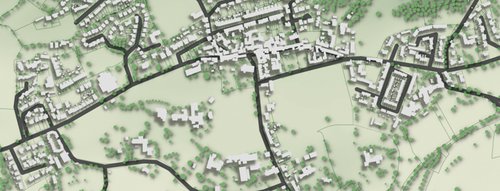
- Offline JuraMap downloads
- Divide & Map - Now (DAMN) micromapping tasking manager
- Micromapping trees
- Historical JuraMap aerial photos
- JuraMap feature mapping
- Traccar-OpenGTS integrated GPS tracking
- JuraMap routing
- GEDI forest mapping
- Pasture biomass mapping
- OpenBuildingMap
- rgb-terrain map with TileServer GL and MapLibre GL
- Installing MapLibre GL with TileServer GL
- Pan-sharpened vegetation indices
- High-resolution forest disturbance detection for Kwamtili Forest
- Forest canopy disturbance monitoring
- Mapping Kwamtili
Under the banner Location-Aware Data-Driven Intelligence Management (LADDIM), the latest developments in open data, geo-analytics and open-source mapping are being implemented for specific applications at the local and project levels.
The aim is to identify the LADDIM issues surrounding the co-ordinated integration and implementation of modern OpenStreetMap (OSM), Geographic Information System (GIS) and Building Intelligence Modelling (BIM) technologies by small-to-medium sized consulting engineering firms in less-developed countries.
Various use cases are being discussed with clients and partners. The focus is the assessment of nature-based infrastructure which may be either essentially natural regions or nature based-solutions that combine green and grey infrastructure. Standards and guidance are needed in order to implement LADDIM in these contexts.
Other use cases focus on grassland and forest biomass and biodiversity that are being applied to forests and estate management in Kenya and Tanzania.
Various open-source technologies have been implemented in order to demonstrate LADDIM concepts and how they are applied. These technologies include:
- OpenStreetMap (OSM) back-end and front-end to manage OSM data;
- OSM rendering back-ends and front-ends using Leaflet and OpenLayers;
- OpenGTS/Traccar back-end and front-end to manage mobile phone GPS tracking;
- OpenRouteService (OSR) API back-end with the OSR front-end for routing;
- aoi-osm Area-of-Interest mapping;
- OpenBuildingMap front-end;
- Overpass server API back-end;
- OsmAnd GPS files;
- oshdb/ohsome database and API with front-ends for the historical analysis of OSM data.
Concepts of interest include:
- planning using urban topology (e.g. reblocking, openSidewalks, infrastructure utility);
- location assessment (e.g., going beyond classic routing services - walkability, route optimisation, etc);
- capital and investment monitoring (built environment - buildings, infrastructure; natural environment - land cover; nature-based infrastructure);
- spatial feature identification (e.g., Overpass4j, Orbis, OF4SOM, OSMonto);
- feature attributes organisation (tags, indexes, ontologies, taxonomies);
- physical modelling (e.g., energy, climate, sound, exposure, etc.) based on spatial analytics (e.g., ADEME, URCLIM and ANR CENSE programmes)
- computer-aided mapping (aerial, satellite and ground-level imagery; AI feature extraction, e.g., buildings).
These technologies and concepts need to be placed in the context of the consulting engineering industry's planning, design, procurement, certification, and project management activities albeit, for a specific type of infrastructure.
A hands-on mapping exercise that maps and analyses features of historic, archeological and wildlife interest in Switzerland's Jura Mountains serves as an open-access use case (for a summary of the implementation of the various technologies, see blog post).