High-resolution forest disturbance detection for Kwamtili Forest
Kwamtili Estate blog
Update (August 2023)
A February 2023 update indicated that forest disturbance in Kwamtili was much less in 2022 than in 2021, perhaps because most of the accessible forested areas have already been (illegally) cleared.
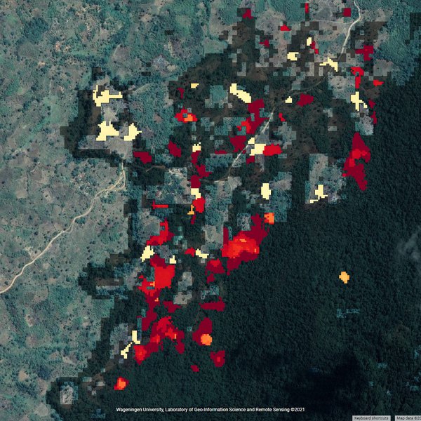
However, Global Forest Watch alerts for the six-month period of 1 January to 31 July in 2022 and 2023 show that the area covered by forest alerts had increased sugnificantly in 2023 compared to 2022. The reasons for this disturbing trend are being investigated. The only consolation is that the boundary between the area that is being impacted by forest activity and the original forested area has remained fairly static (i.e., forest activity - mainly deforestation - is not progressing into the dense, original forest).
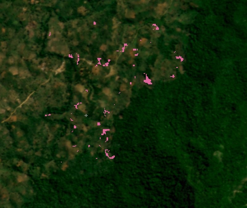
Global Forest Watch alerts (1 January - 30 July 2022)
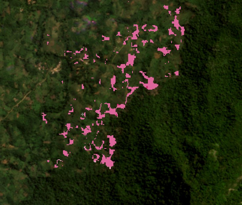
Global Forest Watch alerts (1 January - 30 July 2023)
Original text
The Sentinel 2 satellites offer new opportunities for high-resolution forest disturbance detection. We are exploring the application of Time Series Analysis (TSA) using Sentinel 2 data which so far has mainly been used for forests in temperate zones. Phenological TSA of global satellite imagery must cope with a varying topography and seasonal vegetation effects, which are somewhat reduced in regions close to the Equator but are stll significant in mountainous regions such as the Kwamtili Forest. A planned alerting system for Kwamtili Forest deforestation aims to build upon recent work dealing with forests in Europe.
During the last few decades, earth-observation programmes such as Landsat deliver data which have enabled the implementation of large-scale monitoring systems notably the RADD (RAdar for Detecting Deforestation) alerts which contribute to the Global Forest Watch.
RADD is described as follows: "Radar satellite imagery from the European Space Agency’s Sentinel-1 mission is used to map new disturbances in primary humid tropical forest at 10 m spatial scale and in near real-time. Sentinel-1’s cloud-penetrating radar provides gap-free observations for the tropics consistently every 6 to 12 days. This enables the rapid detection of small-scale forest disturbances, such as subsistence agriculture and selective logging. A new forest disturbance alert is triggered based on a single observation from the latest Sentinel-1 image. Subsequent observations are used to increase confidence and confirm or reject the alert."
The aim is to translate the RADD approach to a more customised and selective tool that uses Sentinel 2 data.
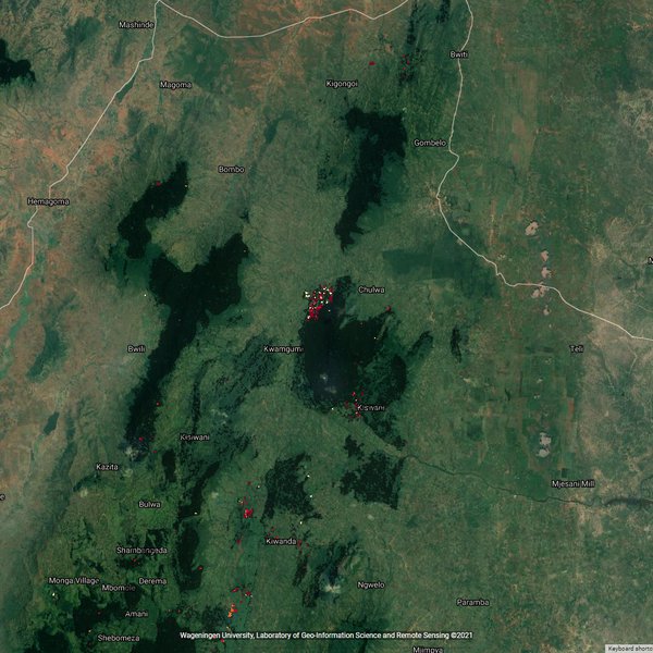
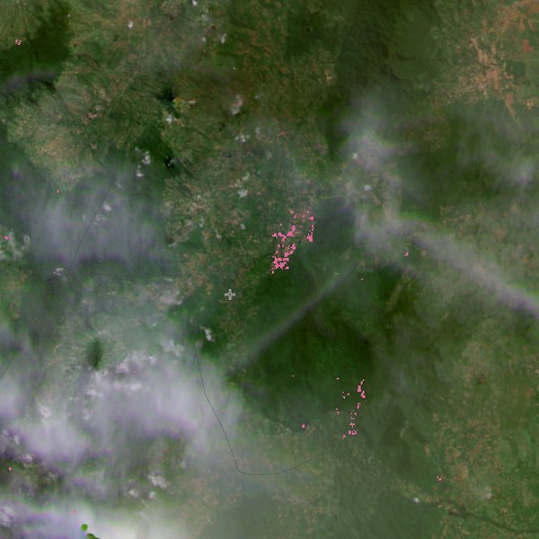
To provide a measure of the problem facing the Kwamtili Forest, given below is the REDD alert map of 6 February 2022 for northern Tanzania. The first image spans an area of 90 by 60 km. It shows that virtually all the forest disturbance alerts in this large area that covers Tanzania's Usumbara Mountains originate in the Kwamtili Forest. The enlargement reveals the encroachment that is taking place.
Updating the REDD alerts for 2023, the images below are from the current REDD alert system for 7 February 2022 and the end of 1 February 2023. The images for 2022 are essentially the same and show considerable forest disturbance during 2021. The last image on the other hand shows that disturbance was much less in 2022. A side-by-side mapping is also available.
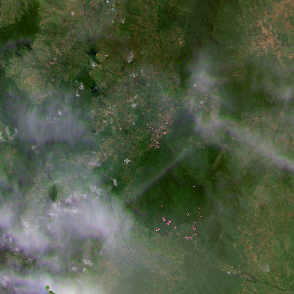
1 February 2023